
Retracing a Hike
Abstract
In 2009 a group of volunteers hiked to a remote mining cabin in the Inyo Mountains, in hopes of restoring it. Trails are not maintained, and information online is scare. To create personal trail maps and profiles, a hand-traced trail was digitized from an old topo map. Various shapefiles were gathered from CalAtlas - orthoimagery, DEMs, and background information on roads and boundaries. Trail profiles were created with 3D Analyst, and a 3D scene was created in ArcScene. Further study should focus on updated trail conditions and history, as much of this information is out of date or scattered across multiple sources.
Introduction
Between the Sierras and the Great Basin, the Inyo Mountains contain evidence of the area's mining history. Prospects, mining cabins, and a network of trails extend throughout the area. In May of 2009 one of these cabins, located at Beveridge Ridge, was restored by a crew of volunteers. The location is remote - all supplies were brought in by helicopter, and it's a two day journey by car and foot to the cabin site. The trails into the interior are not well marked, not well known, and not well maintained.
There are many sites that list trail information - but these are either known trails, or ones denoted by GPS points. The best (and only) information for a good portion of the hike in was a weather beaten copy of a topo map with a hand traced trail. Working from the map copy, is it possible to create a better map? Using ArcMap and ArcScene, trail profiles, maps, and a 3-D model were created - the usefulness to be tested when the weather improves.
Background
By WW1, the Los Angeles Aqueduct had diverted most water from the Owens River to the south, drying up Owens Lake. Swansea became a dry dock, and the ore from the prospects was depleted. Beveridge became a ghost town, and the miner's trails were forgotten and overgrown.
Beveridge is located on BLM lands, and is mostly wilderness. Hikers rediscovered the extensive miner's trails in the 1970s, and established a partnership with the BLM to restore parts of the trails. A few are marked on area topo maps and described on the BLM site (Ridgecrest office). These are not nicely maintained trails, and the environment can be harsh. Some of the few existing mining cabins are used as shelter by hikers.
One of these cabins is located on Beveridge Ridge, above the ghost town of Beveridge. Harsh weather at 8500+ foot elevation left the 100+ year old cabin in danger of collapse. In May of 2009, a group of volunteers from various organizations attempted to stabilize the cabin. Because of the remoteness, all supplies were transported by a Forest Service helicopter. Volunteers drove in along an existing 4WD path, and then hiked for two days to reach the cabin.
Methods
I created separate shapefiles for each feature I wanted to digitize: trails, 4WD, and trams. Using Editor, I did a heads up digitization of the georeferenced map copy - this became the trails layer. I repeated this for the trams layer, using the mosaicked quad raster as reference. A few sites contained information on the 4WD trails in the area - the specific one leading to the trailhead is called the Swansea grade. I georeferenced an image from 4x4 site and added it as an overlay on the mosaicked quad raster. These two layers were used as reference for the creation of the 4WD layer.
After the digitization was complete, I used the line interpolation tool in 3D Analyst to produce trial profiles. A 30m DEM was acquired from the USGS. Using each layer as an overlay, I traced over the digitized trails. This gave me a file that associated X,Y coordinates with an elevation, which was then exported to Excel to convert from meters to feet. A chart was produced for each digitized layer that shows elevation gain and loss. Trail length was derived from the digitized shapefiles.
Simple area maps were created with information from CalAtlas - major roads, water features, and towns in Inyo County. Each layer was clipped to Inyo County, with only major features selected and labeled. The first mapped overlayed this information with the DEM, and the second utilized NAIP orthoimagery from CalAtlas.
The final step was to produce a 3D model of the area using ArcScene. NAIP 1m resolution color imagery from 2009 was acquired from CalAtlas, with four images per quad. 20 of these images were mosaicked together, and draped over the DEM layer, with a vertical exaggeration of 4. I had some trouble adding the digitized trails layers to the model, and so left them off.

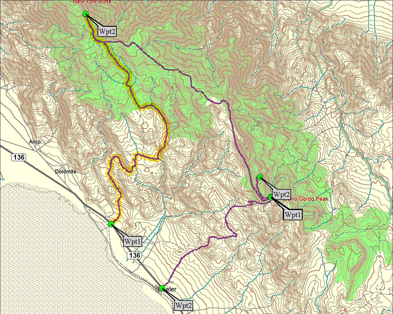
Digitized trails with mosaicked 7.5'' USGS quads. Blue = 4WD trails, and green = hiking trail.

Trails overlayed with DEM. Trams = yellow.

Trails overlayed with NAIP orthoimagery.

3D view created in ArcScene, using the NAIP imagery draped over the DEM. Owens Valley is on the left, with the Inyo Mountains on the right.

Trail profile created for hike from New York Butte to Beveridge Ridge cabin.

Trail profiles created for 4WD trails.
Gathering the information was very interesting. The 7.5'' quads this is based on cover a very small area, and California is a huge state. The naming conversions aren't very clear, and it took a bit to locate the correct maps, DEMs, and NAIP images. While looking through a populated places shape file, I found the towns of Beveridge and Swansea - no one has lived in those towns in decades. Beveridge is a ghost town high in the Inyos, while not much of Swansea remains. They can both be found on Google maps.
Producing the 3D model in ArcScene was troublesome. The 1 meter NAIP imagery takes a long time to render, and I couldn't access any DEMs smaller than 30 meter resolution. Displaying the trails didn't quite work, I'm not sure why. I decided to leave them off the scene for now.
The trail models were easy to create. While 3D Analyst has a tool for a graphical result, the measurements were in meters. Since I didn't want to reproject my data, it was easiest to export everything to Excel and use a simple formula to convert to feet. Length of the trail was left off, as I was unable to get miles to display correctly.
- air-and-space.com/20020623%20Inyos/Map2D_Swansea-Cerro%20Gordo%20Road%20l.jpg
- atlas.ca.gov
- blm.gov/ca/st/en/fo/ridgecrest/beveridge.html
- Bursinger, F., Sep 1996, "California's Beveridge Canyon", Backpacker, 118.
- USGS, 1912, Bulletin - United States Geological Survey, Issue 540 112-113.
- gbr.4wdtrips.net/4x4/swansea.html
- Knopf, A., 1918, A Geologic Reconnaissance of the Inyo Range and the Eastern Slope of the Southern Sierra Nevada, California. USGS.
- Personal copy with hand drawn trail, 7.5'' USGS quad, New York Butte
- seamless.usgs.gov

Stabilized cabin, Beveridge Ridge.